Friday, November 07, 2008

LATEST VF IN ITALY GUIDE - FREE DOWNLOAD

This message from Alberto was posted on the Yahoo-VF-Group Forum.

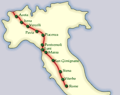
Today I delivered to Italian Culture Ministry the new version of
walking route between Gran San Bernardo and Rome.

It is already published online at the following address:
http://www.librari. beniculturali. it/generaNews. jsp?id=98

You can download free of charge road books, maps, GPS tracks and
Google map tracks.
The road books are in Italian, but they are very schematic, with an
arrow for every crossing so if you process them with an automatic
translator they should be useful.
I suggest you to print road books in A5 format, (2 pages per A4
sheet), on both sides of the sheet to decrease weight (they are about
300 A4 pages that can be reduced to 80-90).

The new route is an evolution of the one published in 2006 by AEVF (I
was the author of that job too). I worked as consultant of Ministry,
cooperating with AEVF members like municipalities, provinces,
regions, and with local associations and agencies to solve the safety
issues of 2006 route. So the new route avoids most of busy roads and
as much as possible stays far from traffic noise and pollution.
The price we are paying is an increasing in route length (about 5%
more than previous version).

I worked also in the preliminary project of simple works that could
improve safety: sidewalks, road crossings, and some major works as
bridges and protected cyclepaths. They could also help in decreasing
route length.

Signs installation has started, and I hope they will complete it
within spring 2009 from Gran San bernardo to Rome. Anyway I suggest
to travel always with the maps (better and lighter a GPS), because
often vandals damage signs.

I hope that this job will be useful for all the future pilgrims on
Via Francigena, and I invite you to contact me to have more
information on the route.

See you soon in Italy!

Alberto Conte
www.camminafrancigena.it

The Road Books (Guides) can be downloaded in sections:

Dal Gran San Bernardo a Ivrea
(Visualizza le tappe su Google Earth)

Tappa: dal Gran San Bernardo a Echevennoz - 14,9 km
Road Book (pdf)
Tracce Google Earth e GPS

Tappa: da Echevennoz ad Aosta - 13,6 km
Road Book (pdf)
Tracce Google Earth e GPS

Tappa: da Aosta a Chatillon - 30,1 km
Road Book (pdf)
Tracce Google Earth e GPS

Tappa: da Chatillon a Verres - 20,8 km
Road Book (pdf)
Tracce Google Earth e GPS

Tappa: da Verres a Pont Saint Martin - 17,7 km
Road Book (pdf)
Tracce Google Earth e GPS

Tappa: da Pont Saint Martin a Ivrea - 22,1 km
Road Book (pdf)
Tracce Google Earth e GPS

Da Ivrea a Pavia
(
Visualizza le tappe su Google Earth
)

Tappa: da Ivrea a Viverone - 21,7 km
Road Book (pdf)
Tracce Google Earth e GPS

Tappa: da Viverone a Santhia' - 16,1 km
Road Book (pdf)
Tracce Google Earth e GPS

Tappa: da Santhia' a Vercelli - 27,4 km
Road Book (pdf)
Tracce Google Earth e GPS

Tappa: da Vercelli a Robbio - 19,7 km
Road Book (pdf)
Tracce Google Earth e GPS

Tappa: da Robbio a Mortara - 14,3 km
Road Book (pdf)
Tracce Google Earth e GPS

Tappa: da Mortara a Garlasco - 23,6 km
Road Book (pdf)
Tracce Google Earth e GPS

Tappa: da Garlasco a Pavia - 25,9 km
Road Book (pdf)
Tracce Google Earth e GPS

Da Pavia al Passo della Cisa
(
Visualizza le tappe su Google Earth)


Tappa: da Pavia a Santa Cristina - 28,5 km
Road Book (pdf)
Tracce Google Earth e GPS
Galleria fotografica

Tappa: da Santa Cristina a Orio Litta - 16,9 km
Road Book (pdf)
Tracce Google Earth e GPS
Galleria fotografica

Tappa: da Orio Litta a Piacenza - 17,5 km
Road Book (pdf)
Tracce Google Earth e GPS
Galleria fotografica

Tappa: da Piacenza a Fiorenzuola - 32,8 km
Road Book (pdf)
Tracce Google Earth e GPS
Galleria fotografica

Tappa: da Fiorenzuola a Fidenza - 22,6 km
Road Book (pdf)
Tracce Google Earth e GPS
Galleria fotografica

Tappa: da Fidenza a Fornovo - 34,2 km
Road Book (pdf)
Tracce Google Earth e GPS
Galleria fotografica

Tappa: da Fornovo a Cassio - 22,6 km
Road Book (pdf)
Tracce Google Earth e GPS
Galleria fotografica

Tappa: da Cassio al Passo della Cisa - 19,2 km
Road Book (pdf)
Tracce Google Earth e GPS
Galleria fotografica

Dal Passo della Cisa a Siena
(
Visualizza le tappe su Google Earth)

Tappa: da Passo della Cisa a Pontremoli - 19,4 km
Road Book (pdf)
Tracce Google Earth e GPS
Galleria fotografica

Tappa: da Pontremoli ad Aulla - 32,9 km
Road Book (pdf)
Tracce Google Earth e GPS
Galleria fotografica

Tappa: da Aulla a Avenza - 32,4 km
Road Book (pdf)
Tracce Google Earth e GPS
Galleria fotografica

Tappa: da Avenza a Pietrasanta - 27,8 km
Road Book (pdf)
Tracce Google Earth e GPS
Galleria fotografica

Tappa: da Pietrasanta a Lucca - 32,3 km
Road Book (pdf)
Tracce Google Earth e GPS
Galleria fotografica

Tappa: da Lucca a Altopascio - 17,8 km
Road Book (pdf)
Tracce Google Earth e GPS
Galleria fotografica

Tappa: da Altopascio a San Miniato - 23,5 km
Road Book (pdf)
Tracce Google Earth e GPS
Galleria fotografica

Tappa: da San Miniato a Gambassi Terme - 25,6 km
Road Book (pdf)
Tracce Google Earth e GPS
Galleria fotografica

Tappa: da Gambassi Terme a San Gimignano - 13,4 km
Road Book (pdf)
Tracce Google Earth e GPS
Galleria fotografica

Tappa: da San Gimignano a Monteriggioni - 29,8 km
Road Book (pdf)
Tracce Google Earth e GPS
Galleria fotografica

Tappa: da Monteriggioni a Siena - 20,5 km
Road Book (pdf)
Tracce Google Earth e GPS
Galleria fotografica

Da Siena a Roma
(
Visualizza le tappe su Google Earth)

Tappa: da Siena a Ponte D'Arbia - 28,5 km
Road Book (pdf)
Tracce Google Earth e GPS
Galleria fotografica

Tappa: da Ponte D'Arbia a S. Quirico d'Orcia - 27,4 km
Road Book (pdf)
Tracce Google Earth e GPS
Galleria fotografica

Tappa: da S. Quirico d'Orcia a Radicofani - 32,7 km
Road Book (pdf)
Tracce Google Earth e GPS
Galleria fotografica

Tappa: da Radicofani a Acquapendente - 31,8 km
Road Book (pdf)
Tracce Google Earth e GPS
Galleria fotografica

Tappa: da Acquapendente a Bolsena - 22,1 km
Road Book (pdf)
Tracce Google Earth e GPS
Galleria fotografica

Tappa: da Bolsena a Montefiascone - 18,3 km
Road Book (pdf)
Tracce Google Earth e GPS
Galleria fotografica

Tappa: da Montefiascone a Viterbo - 17,7 km
Road Book (pdf)
Tracce Google Earth e GPS
Galleria fotografica

Tappa: da Viterbo a Vetralla - 20,0 km
Road Book (pdf)
Tracce Google Earth e GPS
Galleria fotografica

Tappa: da Vetralla a Sutri - 22,5 km
Road Book (pdf)
Tracce Google Earth e GPS
Galleria fotografica

Tappa: da Sutri a Campagnano - 24,3 km
Road Book (pdf)
Tracce Google Earth e GPS
Galleria fotografica

Tappa: da Campagnano a La Storta - 24,4 km
Road Book (pdf)
Tracce Google Earth e GPS
Galleria fotografica

Tappa: da La Storta a Roma - 15,8 km
Road Book (pdf)
Tracce Google Earth e GPS
Galleria fotografica
Wednesday, November 05, 2008

PILGRIMS FROM NON EU COUNTRIES WILL NOT BE ABLE TO WALK THE ENTIRE VF

Since 1987, the Cultural-Routes of Europe committees have worked tirelessly to establish and extend pilgrimage trails in Europe. Some are between 1900km (Canterbury to Rome) or even 5000km (Jerusalem).
When Switzerland joins the Schengen zone on 5th December, pilgrims from the Non-EU countries will no longer have sufficient time to walk these routes. 90 days is not ehough time for anyone to walk nearly 2000km. It was sufficient when one spent 10 days walking in Switzerland, but from 5th December this will change.
Although more and more countries have joined the Schengen zone - and further expansions are planned - the time allowed to visitors has not been increased.
The EU and the Schengen zone countries should consider extending the period allowed for people to walk across Europe along the old pilgrimage trails that are so painstakingly being re-annimated.
There are a number of pilgrimage routes that non-EU pilgrims will be able to walk
  • VF from Canterbury to Rome ± 1900km
  • Via Turonensis, Paris to Santiago ± 1800km
  • Via Lemovensis from Vezelay to Santiago ± 1750km

Monday, October 27, 2008

A new VF Route through Italy

Visit: http://groups.yahoo.com/group/via-francigena/ for up-to-date news on the Via Francigena.

Alberto Conti joined the VF Yahoo group this week. This is his introduction:

I joined the group because Via Francigena is my passion, and my main job application: I work on walking and cycling routes, analyzing the country, walking on routes recording GPS tracks, processing them to obtain guides, maps and information useful for my customers. In 2005-2006 I worked for the European Association of Via Francigena (AEVF) collecting material, verifying on the ground the complete route (walking and biking) and preparing the maps published on website www.viafrancigena.eu.

From 2006 to 2008 I worked for Italian Culture Ministry on route upgrade, cooperating with local agencies and municipalities to improve safety and to go as far as possible from traffic roads. The result is a new guide, published free of charge on internet with GPS and Google Earth tracks, on the following link: http://www.librari.beniculturali.it/generaNews.jsp?id=98 . The route shall be definitively approved by the evaluation board (Consulta), within the end of 2008, and then it will become the official route for the government, on which they will install signposts etc.

The headquarter of my company, called itinerAria, is in a country house in Roppolo, in Piemonte, on Via Francigena. We have space and rooms, so I am pleased to host pilgrims free of charge, if they contact me in advance and I am not traveling. I know all Italian route very well, so please do not hesitate to contact me to have up to date information on the Via Francigena. Buon Cammino, Alberto Conte
itinerAria www.itineraria.eu


In response to a query re maps and routes, Alberto had this to say:

The AEVF maps have been replaced by the maps and road-book you can download by the following link: http://www.itineraria.eu/wp-content/gpx-viewer.php?gpxfile=http://www.itineraria\ .eu/wp-content/uploads/francigena/gpx/Francige_index0.xml By clicking on the pilgrims you can open more detailed maps of 5 different areas of Via Francigena: clicking again on the pilgrim you can choose to download the road book in pdf, the GPX track or the KMZ. The maps are about 1:25.000, but they are not very detailed because are obtained by Garmin vector maps. I hope that next year new paper topo maps will be prepared.

I went onto his website and although it has an English link, there is no English on the site as yet.

I also opened the link he gave and clicked on the pilgrims and downloaded one of the 'road-books' - a pdf. file with 10 pages of instructions and directions for using gps and other info.

I wonder how this new route affects the existing guide books by Monica D'Atti and Franco Cinti as well as the Engloish guide books by Lightfoot?


I also found this link for a Via Leona Romea trail which is a 300kms route that starts at Venice and connects with the VF at Altopascio
http://www.amicidisantiago.it/romea/leona.htm

In June 2008 a group of pilgrims walked the path specifically to check the feasibility. The consensus was that that the route identified is feasible and interesting, indeed it could hardly have been imagined that in this part of Italy so urbanized, industrialized inhabited, that there could be paths so quiet.

During the journey they added yellow arrows (where possible) to assist those who will come later. Moreover, the path was also created with GPS for those who want to use this modern guidance system.
They talk about a lack of signs, infrastructure and accommodation but hope that the popularity of the trail will grow so that the relative authorities will consider supporting the route.

Friday, July 18, 2008

2008 UPDATES


A few updates since I last posted.

Since we walked to Rome - two years ago this month - another ± 450 pilgrims have received the certificate of completion. That doesn't mean that only this number walked the VF routes - only that this small number received the certificate. Over 214 000 pilgrims received the Compostela in Santiago in 2006/2007. Many more thousands walked parts of the caminos but did not collect a certificate in Santiago.

PILGRIMS TO ROME

www.pilgrimstorome.org.uk

The Confraternity of Pilgrims to Rome 1st AGM was held on 27th April 2008 where they adopted a Constitution and formally elected a Steering Group which meets on the 3rd Tuesday of every 4th month. General Meetings open to all will continue on a regular basis - the next one is Saturday 1st November.

For now, membership is free but this will change in 2009. Members can order a ‘Pilgrim Record’ from the website

Pilgrim Practical Day

They will have their first Pilgrim Practical Day on Saturday 7th February 2009. It will be a half day running from 10:00 to 14:00. Venue will be either St James’s Church Picccadilly or St Alphage Church Hall - to be confirmed. (St Alphage was a former Bishop of Canterbury)

Ann Milner, webmaster for the Confraternity of Pilgrims To Rome, is walking on the VF right now - from London to Rome and then up to Assisi. Follow her blog here: www.walk2assis.blogspot.com


Guides in English

http://www.pilgrimagepublications.com/UKShop/PayPal/ppbooks.html

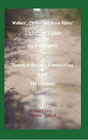
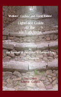
This is the first volume in a two volume guide for walkers, cyclists and horse-riders travelling the Via Francigena. The first volume covers the 1030 kilometres from Canterbury to the summit of the Great Saint Bernard Pass on the Swiss-Italian border. Each volume contains detailed routing instructions, route schematics, listings of accommodation and services and descriptions of the history of key locations along the route. Purchasers of the book are entitled to receive GPS waypoint data and periodic route updates for area covered.

The second volume covers the 942 kilometres from the summit of the Great Saint Bernard Pass on the Swiss-Italian border to St Peter's Square in Rome. Purchasers of the book are entitled to receive GPS waypoint data and periodic route updates for area covered.


WEBSITES:

News from the AIVF: http://www.francigena-international.org/

MEMBERSHIP FEES for 12 months

Individual 26 €
Family or Couple 40 €
Under 25 16 €
Supporter organisation 120 €


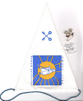
I don’t know what the benefit of becoming a member is as you still have to pay 7 € each for a badge or flag and 5 € for the brooch: 5 € and 8 € for a list of accommodations between Canterbury and Gr St Bernard and Aosta to Rome: 16 € for maps from Gr St Bernard to Rome (if they are the same set that we bought, I must say that they are practically useless to use for walking)

GUIDES by AMIS PILGRIMS

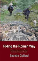
- Riding the Roman Way GB Babette & Paul Chinn 2007

- Walking with Awareness + VF by Michael Metras USA

- Die Via Francigena 2007 DE von Birgit Goetzmann Stein Verlag-DE Kulturelle Beschreibung des Weges 14,90€


The Testimonium:

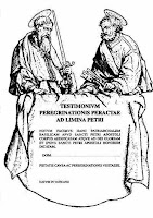
TESTIMONIUM Peregrinatoris ad Limina Petri (IV) -the only original since 6.2001- a parchment in limited edition, created by AIVF, will be given at the sacristy of St-Peter's Basilica, if possible in the Grottoes by Mons. Bruno Vercesi to pilgrims that have walked at least from Acquapendente to St Peter’s (150km) or cycled from Lucca (400km)


News from the AEVF website: http://www.viafrancigena.eu/

Near the office of Saint Peter of the Opera Romana Pellegrinaggi, anyone is yearning to face the adventure to travel on foot, by bus or by car the historical ways of the Faith, will be able to receive all the useful informations and a series of catalogues containing deepenings and proposals.
This is where you will get your "Romea" or "Testimonium" after walking the last 100kms to Rome.

They offer a Credential: Pilgrim's credential

The Credentials of the Pilgrim are a collapsible page, a “identity card” that the pilgrim will compile during its travel, to test and memory of the completed way

You can order it at the Tourist Office in Fidenza. You simply have to send a letter containing a self-addressed stamped priority mail envelope (2,80 € + return receipt 0,60 €) to the following address: Associazione Europea Vie Francigene: Piazza Duomo, 16 -43036 Fidenza – PR.

- or you can get it directly at the Central Office of the European Association of Vie Francigene in Fidenza (Pr) – Piazza Duomo, 16 . Opening hours: Every day from 9.00 to 12.30, and from 15.00 to 17.00)

The Credential is available also by other Associations: Iubilantes, Confraternita dei Romei, Association Via Francigena, Confraternita di San Jacopo di Compostela, Eurovia.

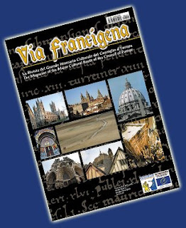
Via Francigena: The latest 6 monthly glossy newsletter is now available from the Revista website. It costs 6 euro + 4 euro postage.

http://www.rivistaviafrancigena.it/eng_frames_ok.htm


VF Souvenirs are now available in (the form of Cammini de Europe items)

http://www.camminideuropaline.eu/ita/souvenir.asp


Other news:

UPDATES ON THE ROUTES

The province of Imperia have published a leaflet on their 83km
section of the coastal route linking Menton with Sarzana.
http://www.confraternitadisanjacopo.it/Francigena/viafrancigena/ViaDellaCosta_Im\
peria.htm

Infuriatingly, I can't find any mention of it on their website, but
there's an overview profile of the route at
http://www.provincia.imperia.it/Turismo/Escursioni/LaViaDellaCosta.htm
It's partly along the coast, and partly inland a bit, visiting the
shrines of the Porrine and Montegrazie (where there are frescoes
related to the Golden Legend story of St James).

This route was officially opened in March as part of their Paths
Festival, when 3 sections of the route were walked
http://www.provincia.imperia.it/site/10583/default.aspx

Submitted by Peter Robins to the Yahoo!Groups - http://groups.yahoo.com/group/via-francigena

AND - WHAT HAPPENED TO THE VF FIVE PILGRIMS?

Sil and Marion walked the Camino Frances from Roncesvalles to Santiago from end of August to end of September 2007.

This photo was taken with a nun from the convent of Santa Clara in Castrojeriz. It is a closed order but this nun was happy to come out after we'd bought a couple of boxes of biscuits, and have her photo taken with us.


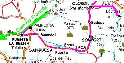
In 2009, Sil, Marion, Val, Kathy - and a new addition, Linda - will walk parts of the Chemin du Piemont in France and the Aragones in Spain.